The key facts
- El Niño in the Pacific is intensifying; the probability of a very strong event in November–January is estimated at 70%
- El Niño in the Pacific is strengthening; the probability of a very strong event in November–January is estimated at 70%
- Uzhydromet expects November to be 1–1.5°C warmer than the norm, but with precipitation at or below the norm
- International centers and independent forecasts give signals of above-normal precipitation in a number of regions
- International centers and the independent forecast give signals of above-normal precipitation in a number of regions
The Pacific Ocean is heating up — and it already looks like a super El Niño
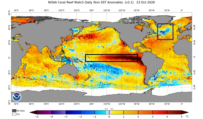
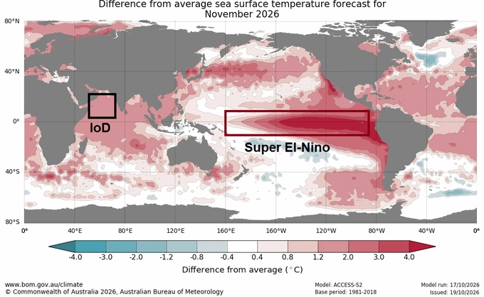
The Pacific Ocean in the equatorial zone is rapidly warming: at the end of October, the water temperature in the El Niño and La Niña observation zone is anomalously high. According to the international ocean-atmosphere climate center, the probability that El Niño will become a very strong event in November–January is 70%. Climatologist Erkin Abdullakhatov, who shared with Gazeta.uz the forecast for November, calls this process a “super El Niño” — nothing like it has been observed for many years. Similar episodes in the past — 1982–1983, 1997–1998 and 2015–2016 — were accompanied by abundant precipitation in Central Asia, including most of Uzbekistan, during the autumn-winter seasons.
Forecasts diverge on precipitation
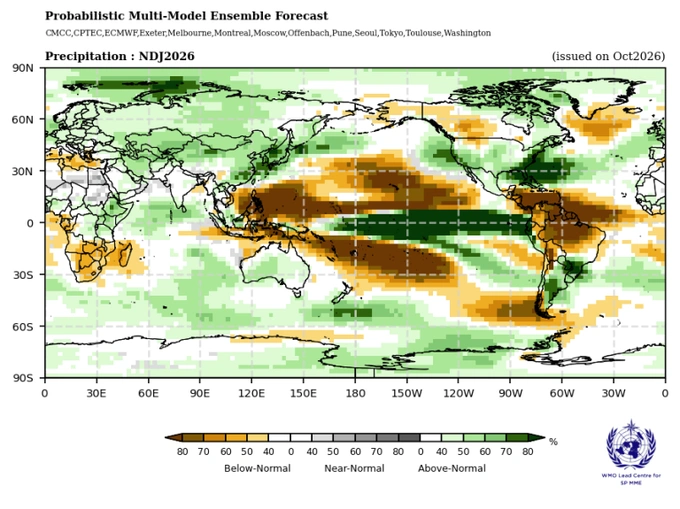
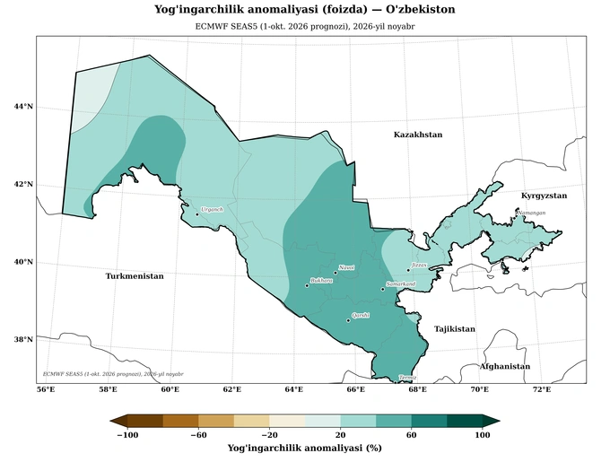
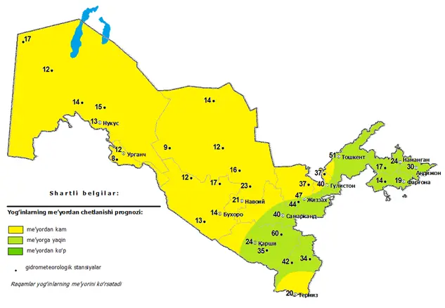
The World Meteorological Organization marked in green on its seasonal map for November, December and January that precipitation in most of Uzbekistan may exceed the norm, although it did not provide a detailed assessment for November itself. Other international forecasting centers, according to Abdullakhatov, are also signaling above-normal precipitation across most of the country. Uzhydromet meanwhile, in its monthly forecast expects precipitation at or below the norm: below the norm — in Karakalpakstan, Khorezm, the Navoi and Bukhara regions (all districts), as well as in most of the Samarkand, Jizzakh and Surkhandarya regions; in the remaining regions — at the norm. The November precipitation norm for the country ranges from 8 to 60 mm depending on the district. This divergence is the key uncertainty of the month: long-term precipitation forecasts have traditionally had a low verification rate.
Warm across almost the entire country
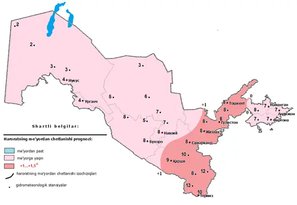
On temperature, the forecasts agree: relying on the conclusions of the WMO and other international centers, Uzhydromet reported that in November, in most of Uzbekistan, the air will be 1–1.5 degrees warmer than usual. According to the agency, in the Kashkadarya, Surkhandarya, Samarkand, Jizzakh, Syrdarya and Tashkent regions, the average monthly temperature is expected to be 1–1.5 degrees above the long-term climate norm. The monthly norm for November is from 0 to +13 degrees. A warm background does not rule out cold waves: we are talking about a predominance of warm days during the month, not their absence. According to the Uzhydromet forecast, the first ten-day period will be relatively warm — at night +5…+10, during the day +17…+22 degrees; in the second and third ten-day periods the temperature will drop to −2…+3 at night and +5…+20 during the day.
What will determine the weather: five factors
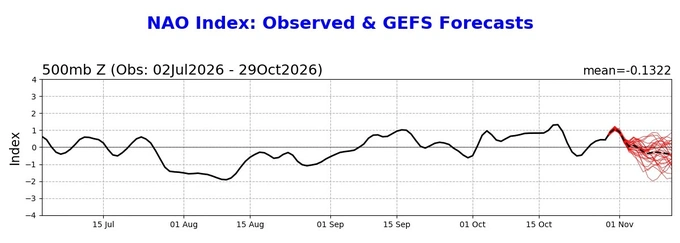
Abdullakhatov identifies several determining factors. The first is El Niño itself: for Central Asia, over the past two years it has not reproduced the precipitation pattern of its past analogues, which climatologists link to the current climate change and Uzbekistan's unfavorable intra-continental position, but the phenomenon remains classified as a “super El Niño” and is giving positive precipitation signals. The second is moisture from the North Atlantic: the North Atlantic circulation, presumably in a negative phase, may bring at least two or three moist air flows into most of the country in November. The third is the warming of the northern Indian Ocean: in early November, the water temperature there is in a positive phase, which may possibly support the moisture reserve for most regions except the northern ones.
Cold invasions and the polar vortex
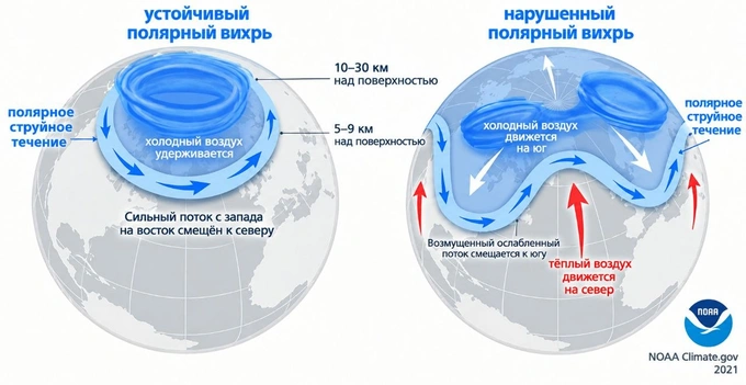
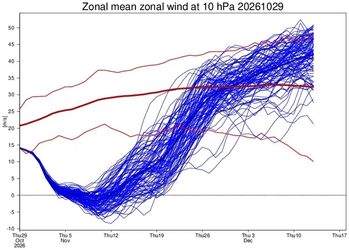
The fourth and fifth factors are the temperature anomaly over the Arctic Circle and the speed of the polar vortex. Currently, at an altitude of about 30 km above the Arctic, the temperature is noticeably above the norm, and the constant winds along the polar circle have slowed sharply; this situation is expected to persist over the next two weeks. This means that in mid-November and early December, another cold anticyclone may penetrate deeper into Uzbekistan and significantly lower the temperature. However, the verification rate of such a forecast is low: according to calculations, from the third ten-day period of November, the wind speed in the polar vortex will intensify again, which reduces the probability of anomalous cold in the second half of December and in January.
The overall picture of November
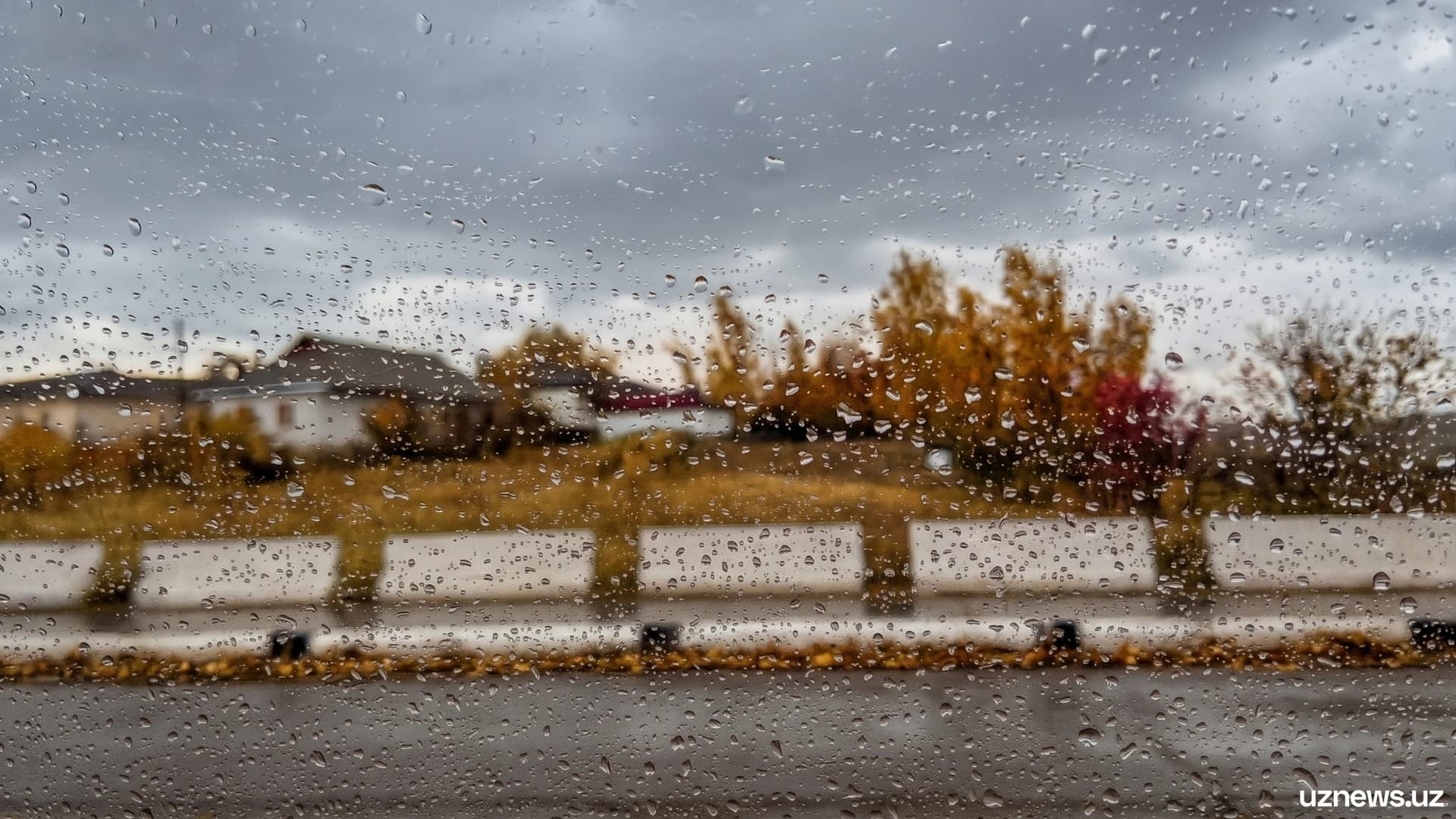
The independent forecast compiled by Abdullakhatov based on five factors diverges from Uzhydromet's assessment on precipitation: in the Samarkand, Jizzakh and Namangan regions (most of their territory), as well as in the Tashkent and Syrdarya regions, precipitation may reach up to 130% of the monthly norm — a wet November is expected there. In Karakalpakstan, Khorezm and the Kyzylkum deserts, historically low-moisture areas, only 70–90% of the norm is expected — a dry month. Precipitation is likely in the first half of the month and in the third ten-day period, in places as snow; short cold snaps are possible in the middle and end of the month. Across the whole country, except the north and the Kyzylkums, at least one moist air flow with precipitation is expected in each ten-day period. On individual days rain is possible, and during cold spells there may be a brief transition of rain into snow. The Australian Bureau of Meteorology, whose data are also cited in the analysis, confirms the picture of the state of the Pacific indices. The authors remind readers: methods that provide accuracy above 60–70% for each month of the cold season do not yet exist.