The key facts
- The panorama update is being carried out at the initiative of the capital's hokimiyat
- Most of the previous images were taken about five years ago
- The first stage covers the center, parks and tourist attractions, followed by the whole of Tashkent
Panoramas of the capital are being re-shot
Google Maps has begun updating panoramic images and 360-degree videos covering the streets and tourist attractions of Tashkent. The project is being carried out at the initiative of the capital's city administration (hokimiyat), its press service reported. The reason for the update is said to be that most of the existing Street View imagery was taken about five years ago and does not reflect the city's current appearance: for example, the Tashkent City images show construction work, although the district has already been completed.
What is already covered and what comes next
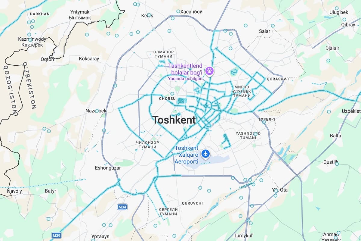
In the first stage, the photography covers central streets, parks and the most visited tourist attractions. A virtual view of Tashkent City park, Amir Temur Square and other places is already available; the panoramas also capture some roads on the way into the city, for example from the Yangiyul side. Streets and places where panoramas can be viewed are marked in blue on the map. The hokimiyat plans to expand the project to the entire territory of Tashkent in the future.
Why it matters
The hokimiyat explained the choice of platform by the fact that Google Maps is used by millions of tourists worldwide: travelers will be able to virtually stroll the streets of Tashkent before arriving, get to know the sights and plan their trip. The Uzbek-language version of the announcement gives a more specific estimate — according to the hokimiyat, more than 2 billion people use the service every month, and it is seen as a 'showcase' for demonstrating the country's tourism potential. The figures cited are statements by the city administration; no independent verification of them has been published.