The key facts
- Cold front No. 2 is affecting southern and southeastern Mexico; the warning covers seven states, including Veracruz, Tabasco, Chiapas and Oaxaca.
- Evacuations are being carried out in southern Veracruz with the support of federal forces.
- Heavy rains, wind gusts of up to 80 km/h and waves of 2–4 meters are forecast.
Warning for Seven States
Mexico's National Civil Protection Coordination (CNPC) on Monday published on its official website an appeal to residents of seven states — Veracruz, Tabasco, Chiapas, Oaxaca, Campeche, Yucatán and Quintana Roo — urging them to follow official recommendations and strengthen self-protection measures. The reason is cold front No. 2, which continues to affect the country's south and southeast.
Flood and Landslide Risks
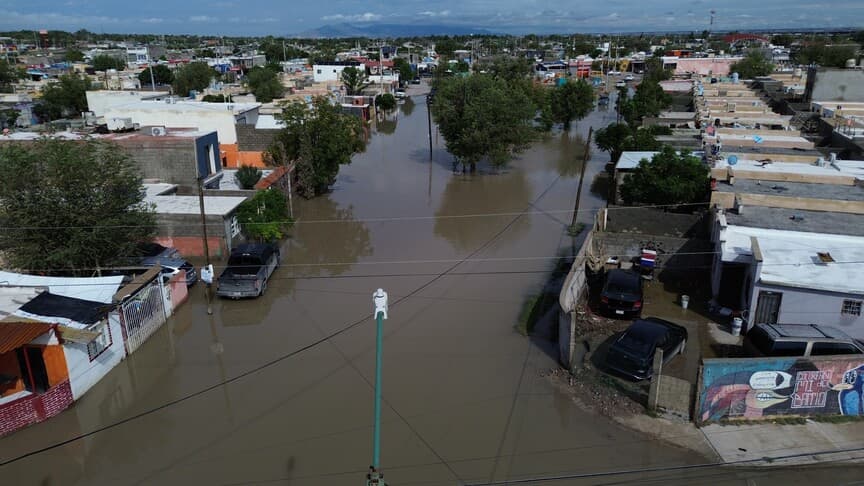
According to the agency, the prolonged rains of recent days have increased the risk of floods, flash floods, rising river levels, water bodies overflowing their banks and landslides. The CNPC warned that moisture-saturated soil could trigger mudslides and slope collapses, while rising water could threaten settlements near rivers and streams.
Evacuations in Veracruz
In municipalities in the southern part of the state of Veracruz, authorities are carrying out evacuations and moving residents to safe zones; the operations are supported by federal forces.
Weather Forecast
According to the National Meteorological Service (SMN), the front will remain nearly stationary over the eastern and southeastern part of the Gulf of Mexico. Torrential rains are expected in southern Veracruz, western Tabasco, northwestern Chiapas and northeastern Oaxaca; very heavy rains in parts of Yucatán and Quintana Roo, and heavy showers in areas of Campeche. A polar air mass will bring a cold snap, with north wind gusts of 60–80 km/h in Veracruz, on the Isthmus and in the Isthmus of Tehuantepec, and 40–60 km/h in Tabasco, as well as waves 2–4 meters high along the affected coasts and in the Gulf of Tehuantepec.
Recommendations for the Population
Residents were advised not to cross flooded streets, rivers and streams on foot or by vehicle, to avoid areas vulnerable to floods and landslides, as well as beaches and coastal areas with strong winds and high waves. Residents of low-lying areas were recommended to determine evacuation routes and temporary shelters in advance, and, if given an evacuation order, to leave the danger zone immediately. The agency also urged people to follow updates from official meteorological channels and civil protection services.